Whitfield County Tax Parcel Information
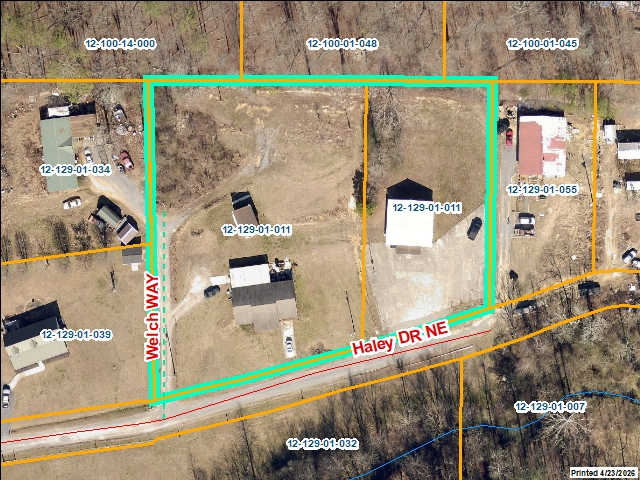
Owner and Parcel Information

Parcel Number 12-129-01-011
Realkey 13541
Property Record Card Click Here
GIS Map Map
Owner Name WATTS ELBERT LEE
Owner Address 1286 HALEY DR
Owner Address 2
Owner Address 3
Owner City DALTON
Owner State GA
Owner Zip 30720
Latitude 34.812009
Longitude -84.92215782
Property Information
Class Commercial
Strata Lot
Tax District County
Neighborhood
Legal Description LTS 95T106WHITE
Total Acres 1.53
Zoning See GIS Map
GMD\Map Number 105
Subdivision
Subdivision Phase
Subdivision Section 0002
Subdivision Block
Subdivision Lot
Comments:
Appeals Information
This parcel does not have any appeals
Parcel Address
Parcel House Number 1286
Parcel Street Extension
Parcel Street Direction NE
Parcel Street Name HALEY
Parcel Street Units
Parcel Street Type DR
Current Fair Market Value Information
Previous 357946
Current 357946
Land 76500
Residential Improvement 193876
Commercial Improvement 85553
Accessory Improvement 2017
Conservation Use Value
Historical Fair Market Value Information
2023 207263
2022 179220
2021 179220
Exemption Information
Homestead S3
Preferential Year
Conservation Use Year
Historical Year
Historical Val 0
EZ year
EZ Val 0
 GIS Quickmap
Launch Interactive GIS Map
 For the current GIS map of this parcel, click on the Quickmap to launch the interactive map viewer
 Tax Commissioner Information
  Before making payment verify the amount due with the Tax Commissioner s office at 706-275-7510
Tax Bill Recipient WATTS ELBERT LEE
Year 2025
Parcel Number 12-129-01-011
Bill 239706
Exemption Type S3
Account No. 7071726
Millage Rate 0
Fair Market Value 357946
Assessed Value 143178
Prior Years Tax Data Tax
Legal Description LTS 95T106WHITE
Sale Date
Taxes Due 2855.64
Taxes Due Date 1/20/2026
Taxes Paid 533.55
Taxes Paid Date 5/13/2026 3:51:47 PM
Current Due 2413.82
Back Taxes 0
Total Due 2413.82
   
 Commercial Structure Information
General
Improvement Number 1
Section Number 1
Sketch Click Here
Class Commercial
Strata Improvement
Built As *Church
Used As *Church
Grade 100
Physical Depreciation 0.6
Structure value 85553
Section Value 85553
Total Improvement Value 85553
Comments:
Construction Information
Construction Type Wood/Steel Combination
Wall Height 8
Year Built 1991
Effective Year Built 1991
Section Area 1520
Total Building Area 1520
Plumbing
One Fixture 0
Two Fixture 2
Three Fixture 0
Bath\Kitchen 0
1.5 Bath\Kitchen 0
2 Bath\Kitchen 0


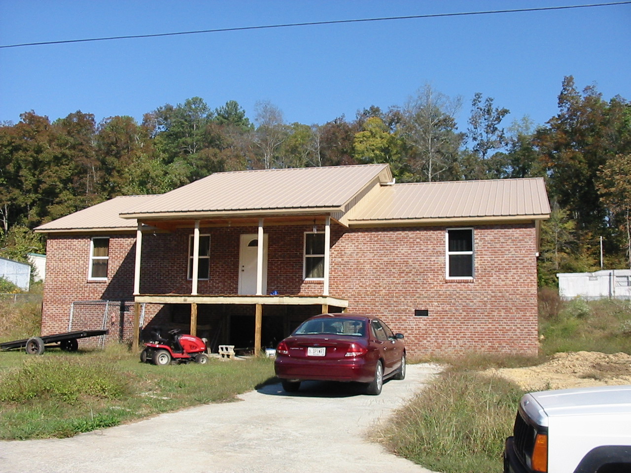
 Residential Structure Information
General
Value 193876
Class Commercial
Strata Improvement
Occupancy Single Family Residence
Year Built 2010
Observed Condition Fair
Heated Area 1760
Structure Sketch Click Here
Comments: HOUSE BURNED IN 2011
Plumbing
Full Baths 2
Half Baths 0
Standard Complements 1
Extra Features 3
Construction Information
Foundation Piers
Exterior Walls Br Veneer
Roofing Asphalt Shingle
Roof Shape Gable/Hip
Floor Construction Cont. Wall
Floor Finish Carpet/Wood
Interior Wall Sheetrock/Drywall
Interior Ceiling Sheetrock
Heat Floor/Wall Furnace
Story Height 1 STORY
Basement/Attic Information
Basement Description
Basement Finish
Attic Description
 Accessory Information
Description STORAGE
Value 980
Year Built 1980
Calculated Area 0
Length 0
Width 0
Class Commercial
Strata Improvement
Description CARPORT
Value 1037
Year Built 1995
Calculated Area 576
Length 18
Width 32
Class Commercial
Strata Improvement
 Sales Information
Grantee WATTS ELBERT LEE
Grantor WATTS NORMA JEAN
Sale Price 0
Sale Date 4/4/2014
Deed Book/Page 6021 7
Deed Link Click Here
Class Residential
Strata Improvement
Reason DEED OF GIFT
State N
PT-61 PT-61 155-2014-000000
Comments WARRANTY DEED OF GIFT
Grantee WATTS NORMA JEAN
Grantor WATTS ELBERT LEE
Sale Price 0
Sale Date 1/21/2011
Deed Book/Page 5563 278
Deed Link Click Here
Class Residential
Strata Improvement
Reason Structure Full/Partial Removed
State N
PT-61 PT-61 155-2012-000000
Comments
Grantee WATTS ELBERT LEE
Grantor
Sale Price 0
Sale Date 2/1/1990
Deed Book/Page 2113 303
Deed Link Click Here
Class Residential
Strata Lot
Reason
State N
PT-61
Comments