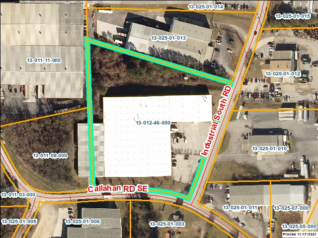
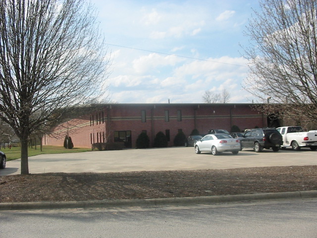
Whitfield County Tax Parcel Information
Owner and Parcel Information
Parcel Number
13-012-46-000
Realkey
30578
Property Record Card
Click Here
GIS Map
Map
Owner Name
WHITWORTH-FOSTER LLC
Owner Address
P O BOX 3746
Owner Address 2
Owner Address 3
Owner City
DALTON
Owner State
GA
Owner Zip
30719
Latitude
34.71172493
Longitude
-84.95372507
Property Information
Class
Industrial
Strata
Small Tract
Tax District
City of Dalton
Neighborhood
IMFG L
Legal Description
5A LL12 13
Total Acres
5
Zoning
See GIS Map
GMD\Map Number
086
Subdivision
Subdivision Phase
Subdivision Section
0009
Subdivision Block
Subdivision Lot
Comments:
Appeals Information
This parcel does not have any appeals
Parcel Address
Parcel House Number
641
Parcel Street Extension
Parcel Street Direction
SE
Parcel Street Name
CALLAHAN
Parcel Street Units
Parcel Street Type
RD
Current Fair Market Value Information
Previous
3304519
Current
2881134
Land
148750
Residential Improvement
Commercial Improvement
2732384
Accessory Improvement
Conservation Use Value
Historical Fair Market Value Information
2022
1999325
2021
1999325
2020
1999325
Exemption Information
Homestead
S0
Preferential Year
Conservation Use Year
Historical Year
Historical Val
0
EZ year
EZ Val
0
GIS Quickmap
For the current GIS map of this parcel, click on the Quickmap to launch the interactive map viewer
Tax Commissioner Information
Before making payment verify the amount due with the Tax Commissioner’s office at 706-275-7510
Tax Bill Recipient
WHITWORTH-FOSTER LLC
Year
2024
Parcel Number
13-012-46-000
Bill
240295
Exemption Type
Account No.
7061873
Millage Rate
0
Fair Market Value
3577431
Assessed Value
1430972
Prior Years Tax Data
Tax
Legal Description
5A LL12 13
Sale Date
Taxes Due
48235.93
Taxes Due Date
1/20/2025
Taxes Paid
48235.93
Taxes Paid Date
12/31/2024 2:06:41 PM
Current Due
0
Back Taxes
0
Total Due
0
 
 
Commercial Structure Information
General
Improvement Number
1
Section Number
1
Sketch
Click Here
Class
Industrial
Strata
Improvement
Built As
*Industrial Warehouse General
Used As
*Industrial Warehouse General
Grade
100
Physical Depreciation
0.7
Structure value
2732384
Section Value
2732384
Total Improvement Value
2732384
Comments:
Construction Information
Construction Type
Masonry Load Bearing Walls
Wall Height
18
Year Built
1988
Effective Year Built
1988
Section Area
112750
Total Building Area
112750
Plumbing
One Fixture
0
Two Fixture
0
Three Fixture
6
Bath\Kitchen
0
1.5 Bath\Kitchen
0
2 Bath\Kitchen
0
Residential Structure Information
This parcel does not have any residential structures to display
Accessory Information
This parcel does not have any accessories to display
Sales Information
Grantee
WHITWORTH-FOSTER LLC
Grantor
WHITWORTH-FOSTER INVESTMENTS
Sale Price
0
Sale Date
12/21/2010
Deed Book/Page
5557 98
Deed Link
Click Here
Class
Industrial
Strata
Improvement
Reason
State
N
PT-61
PT-61 155-2011-000000
Comments
DEED ALSO INCLUDES 13-011-08-000