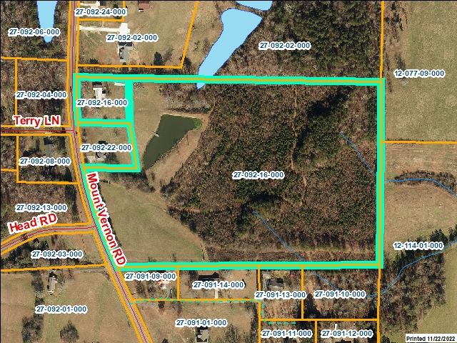
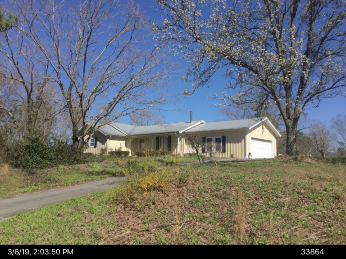
Whitfield County Tax Parcel Information
Owner and Parcel Information
Parcel Number
27-092-16-000
Realkey
33864
Property Record Card
Click Here
GIS Map
Map
Owner Name
LANGLEY ANGELA BROWN
Owner Address
1193 MT VERNON RD
Owner Address 2
Owner Address 3
Owner City
TUNNEL HILL
Owner State
GA
Owner Zip
30755
Latitude
34.81808415
Longitude
-85.05506753
Property Information
Class
Residential
Strata
Lot
Tax District
County
Neighborhood
Legal Description
27.03A EMMETT & VA LINGERFELT
Total Acres
27.03
Zoning
See GIS Map
GMD\Map Number
018
Subdivision
Subdivision Phase
Subdivision Section
0005
Subdivision Block
Subdivision Lot
Comments:
Appeals Information
Appeal Year
2003
Appeal Status
Resolved
Parcel Address
Parcel House Number
1167
Parcel Street Extension
Parcel Street Direction
Parcel Street Name
MOUNT VERNON
Parcel Street Units
Parcel Street Type
RD
Current Fair Market Value Information
Previous
259668
Current
313435
Land
161418
Residential Improvement
151167
Commercial Improvement
Accessory Improvement
850
Conservation Use Value
Historical Fair Market Value Information
2022
187387
2021
188595
2020
188595
Exemption Information
Homestead
S0
Preferential Year
Conservation Use Year
Historical Year
Historical Val
0
EZ year
EZ Val
0
GIS Quickmap
For the current GIS map of this parcel, click on the Quickmap to launch the interactive map viewer
Tax Commissioner Information
Before making payment verify the amount due with the Tax Commissioner’s office at 706-275-7510
Tax Bill Recipient
LANGLEY ANGELA BROWN
Year
2024
Parcel Number
27-092-16-000
Bill
221601
Exemption Type
Account No.
7102087
Millage Rate
0
Fair Market Value
284995
Assessed Value
113998
Prior Years Tax Data
Tax
Legal Description
27.03A EMMETT & VA LINGERFELT
Sale Date
Taxes Due
3118.19
Taxes Due Date
1/20/2025
Taxes Paid
3118.19
Taxes Paid Date
1/17/2025 11:35:53 AM
Current Due
0
Back Taxes
0
Total Due
0
 
 
Commercial Structure Information
This parcel does not have any commercial structures to display
Residential Structure Information
General
Value
151167
Class
Residential
Strata
Improvement
Occupancy
Single Family Residence
Year Built
1931
Observed Condition
Average
Heated Area
1560
Structure Sketch
Click Here
Comments:
orig house is very old additions come later
Plumbing
Full Baths
1
Half Baths
1
Standard Complements
1
Extra Features
2
Construction Information
Foundation
Masonry
Exterior Walls
Wood
Roofing
Asphalt Shingle
Roof Shape
Gable/Hip
Floor Construction
Cont. Wall
Floor Finish
Carpet/Wood
Interior Wall
Sheetrock/panel
Interior Ceiling
Sheetrock
Heat
Central Htg and Air
Story Height
Basement/Attic Information
Basement Description
None
Basement Finish
Unfinished
Attic Description
No Attic
Accessory Information
Description
UTILITY BLDG
Value
250
Year Built
2002
Calculated Area
64
Length
8
Width
8
Class
Residential
Strata
Production/Storage/Auxiliary
Description
UTILITY BLDG
Value
400
Year Built
2002
Calculated Area
128
Length
8
Width
16
Class
Residential
Strata
Production/Storage/Auxiliary
Description
BARN
Value
200
Year Built
2002
Calculated Area
240
Length
12
Width
20
Class
Residential
Strata
Production/Storage/Auxiliary
Sales Information
Grantee
LANGLEY ANGELA BROWN
Grantor
BROWN PATRICIA J
Sale Price
0
Sale Date
3/4/2022
Deed Book/Page
6965 454
Deed Link
Click Here
Class
Residential
Strata
Improvement
Reason
DEED OF GIFT
State
N
PT-61
PT-61 155-2022-003474
Comments
Grantee
BROWN PATRICIA J
Grantor
BROWN BILLY T
Sale Price
0
Sale Date
11/8/2018
Deed Book/Page
6684 707
Deed Link
Click Here
Class
Residential
Strata
Improvement
Reason
WILLS/ESTATES/TRUSTEES DEEDS/TRUSTS
State
N
PT-61
PT-61 155-2019-000000
Comments
ANGELA LANGLEY AND JEFF BROWN AS PERSONAL REPRESEN
Grantee
BROWN BILLY T
Grantor
BROWN PATRICIA J
Sale Price
0
Sale Date
8/15/2005
Deed Book/Page
4572 004
Deed Link
Click Here
Class
Residential
Strata
Improvement
Reason
Partial Freeport Exemption Granted
State
N
PT-61
PT-61 155-2005-000000
Comments
WARRANTY DEED